Bus rapid transit is an important component of the greater Denver region’s current and future transportation and mobility network. Commonly described as “rail on wheels,” bus rapid transit is defined by the Federal Transit Administration as “a high-quality bus-based transit system that delivers fast and efficient service that may include dedicated lanes, bus ways, traffic signal priority, off-board fare collection, elevated platforms and enhanced stations.”
The region’s first service, the Flatiron Flyer, opened for operation in 2016. The Regional Transportation District in 2019 published the Regional Bus Rapid Transit Feasibility Study, a comprehensive evaluation and prioritization of corridors throughout the region for future investment.
The Denver Regional Council of Governments further refined this work through its 2050 Regional Transportation Plan, which specifically identified 11 bus rapid transit corridors and a regional maintenance facility to be completed by 2050. The region has committed to implementing these corridors to help meet the region's mobility equity and other goals, as well as to help meet federal air quality conformity and state transportation greenhouse gas emission reduction requirements.
DRCOG and other partner agencies in 2023 formed the Regional Bus Rapid Transit Partnership to cooperatively plan, develop and implement multiple bus rapid transit corridors within the metro Denver region. The regional partnership is a unique voluntary collaboration of multiple agencies working together to implement various corridors at different planning and project development stages.
The following agencies are included in the partnership:
- City of Aurora.
- City and County of Denver.
- Colorado Department of Transportation.
- Colorado 119 Coalition (represented by City of Boulder).
- DRCOG.
- RTD.
The regional partnership's guiding principles are:
- Developing and implementing the regional bus rapid transit network is more than a single agency can lead or undertake alone.
- Different agencies may lead various individual bus rapid transit corridor planning and project development efforts, though all agencies will have the opportunity to participate.
- Regional bus rapid transit network implementation will also require a multiagency funding partnership of federal, state, local and other funding sources.
U.S. Department of Transportation Build America Bureau Grant
DRCOG in the fall of 2024 received an almost $1 million Innovative Finance and Asset Concession grant from the U.S. Department of Transportation Build America Bureau. DRCOG will hire subject matter expert advisors in the fields of funding and finance, legal and regulatory, and project development to identify and deploy preconstruction activities to accelerate the implementation of several bus rapid transit corridors.
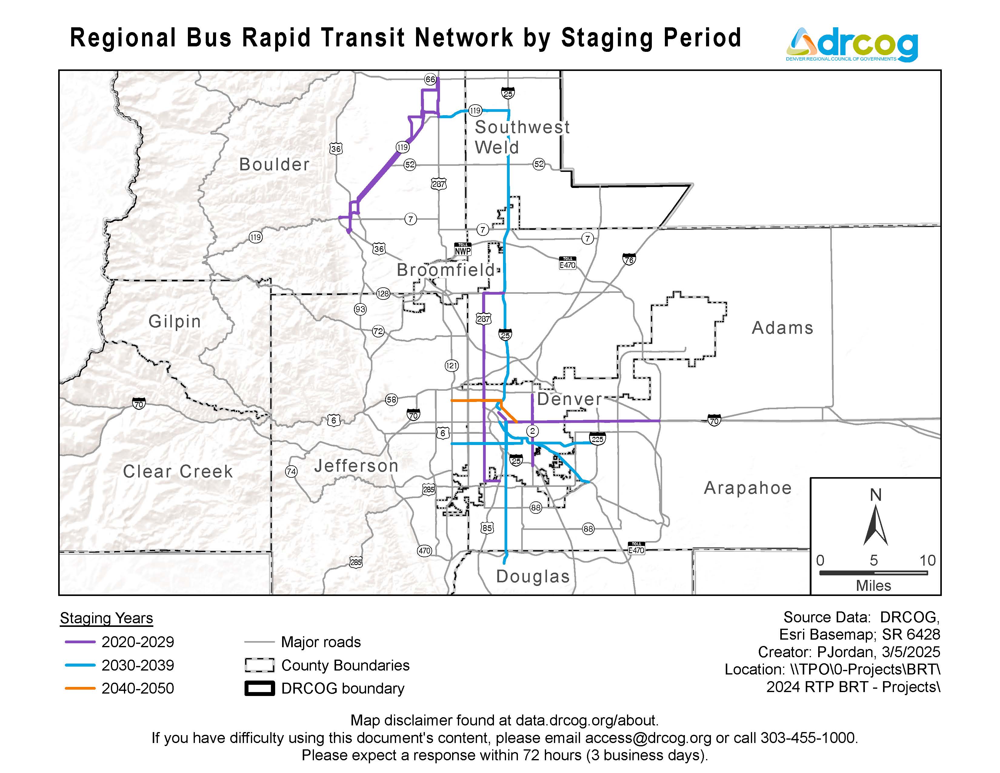
Regional Bus Rapid Transit Network
There are 11 designated bus rapid transit corridors in the 2050 Regional Transportation Plan. Two corridors are under construction, East Colfax and Colorado Highway 119, and two more — Federal Boulevard bus rapid transit and Colorado Boulevard bus rapid transit — are in development under the federal National Environmental Policy Act being led by Colorado Department of Transportation. Additionally, in 2024, DRCOG completed a corridor vision study for the Alameda bus rapid transit corridor. DRCOG is now leading a federally compliant alternatives analysis study for the East Colfax extension bus rapid transit project in partnership with the City of Aurora.
The map below shows the entire network of the eleven bus rapid transit corridors and their implementation period within the 2050 Regional Transportation Plan. Individual profiles of each corridor provide more detailed information. The bus rapid transit corridors are also shown in the following:
- DRCOG's 2050 Regional Transportation Plan interactive webmap.
- DRCOG's Transportation Regional Improvements Projects and Survey database, known as TRIPS.
For more information about regional bus rapid transit planning and Implementation, contact Jacob Riger, multimodal transportation planning manager, 303-480-6751.
Individual bus rapid transit project and corridor profiles
Explore each bus rapid transit project below.
Lead agencies: City and County of Denver and City of Aurora.
Stakeholder agencies: CDOT, DRCOG, Federal Transit Administration and RTD.
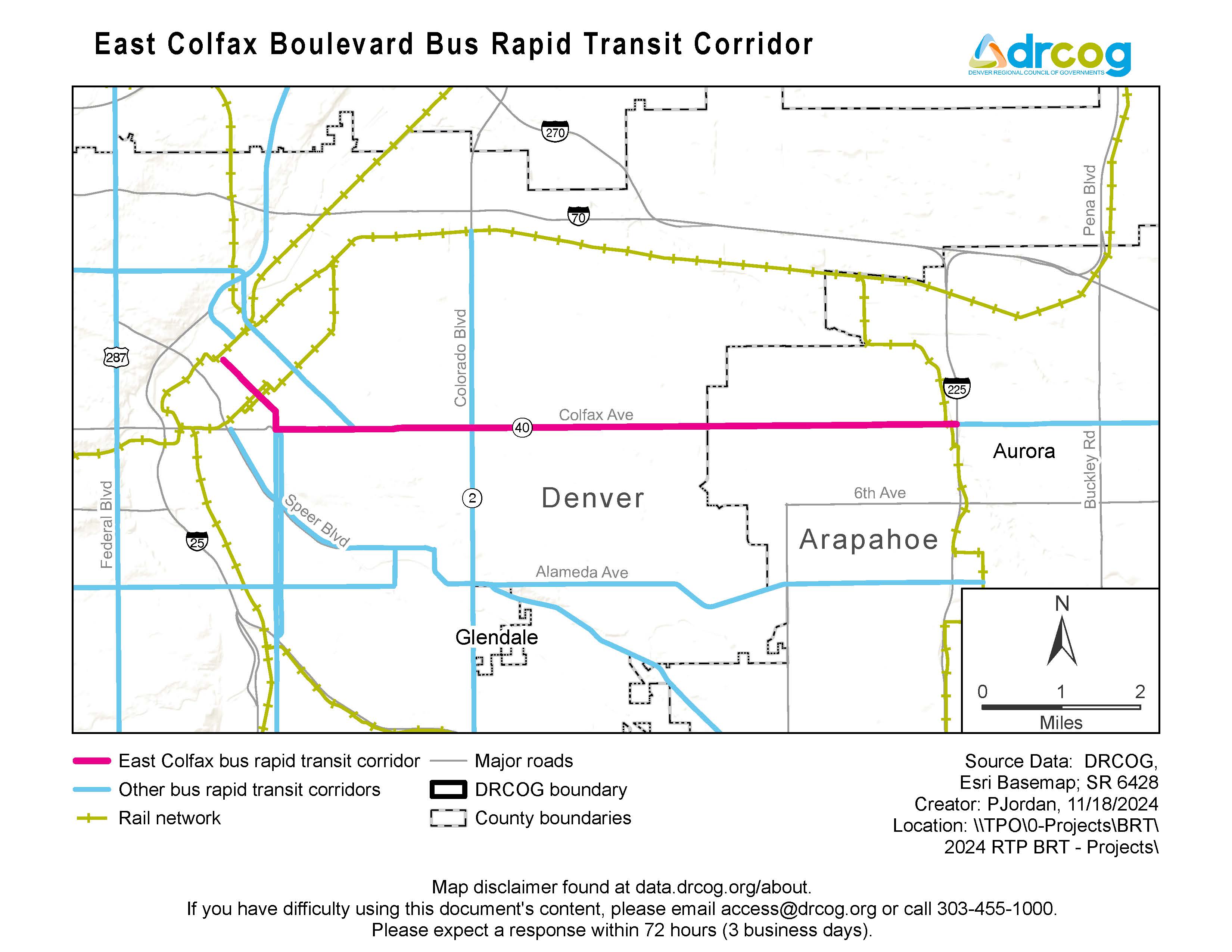
Project and service limits: The bus rapid transit service will extend from Denver Union Station to Interstate 225 and the R Line at Colfax Station. Project construction consists of a dedicated lane on Colfax Avenue from Broadway to Yosemite Street and corridor improvements (such as enhanced stations and speed and reliability improvements) from Yosemite Street to I-225. The service will also use existing bus-only lanes in downtown Denver.
Current status: This project is under construction with anticipated completion in 2027.
Project website: East Colfax Avenue bus rapid transit.
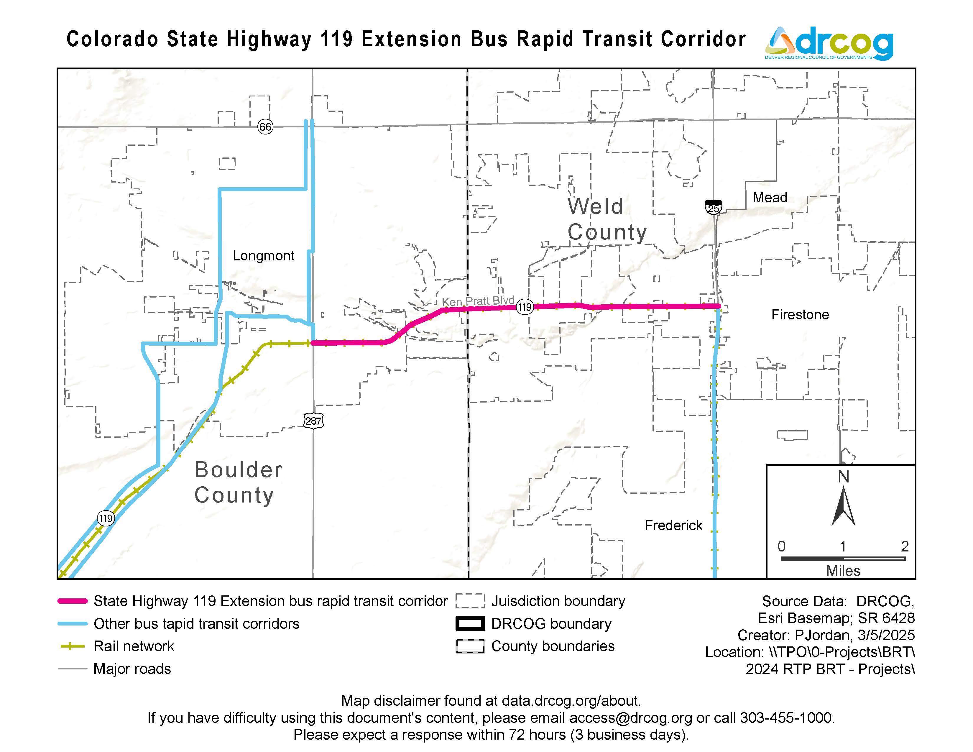
Lead agencies: Colorado Department of Transportation, RTD and Boulder County.
Stakeholder agencies: City of Boulder, City of Longmont, DRCOG and Federal Highway Administration.
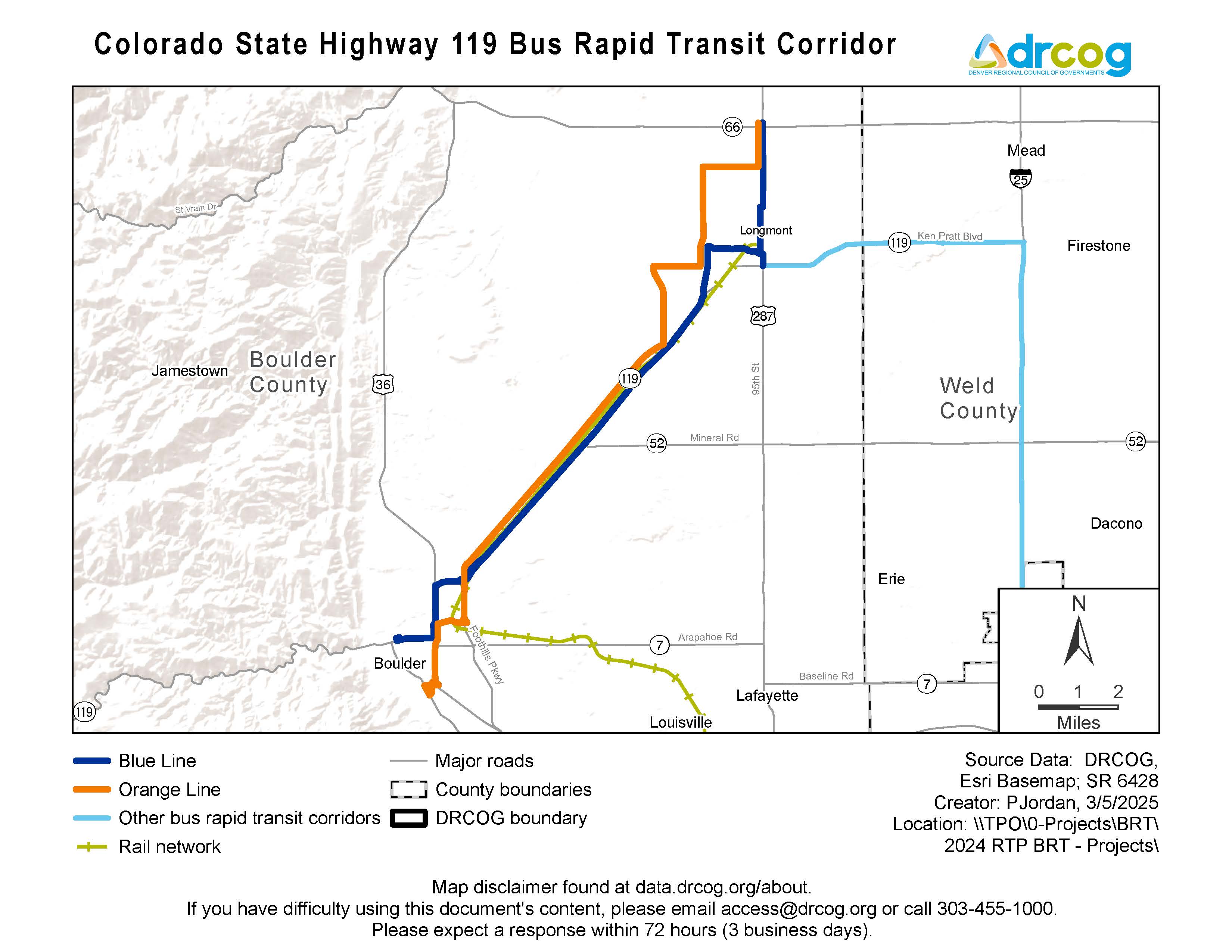
Project and service limits: The bus rapid transit service will extend from downtown Boulder to downtown Longmont on two primary route patterns (see orange and blue lines on the map). Multimodal infrastructure investments are focused on the CO-119 corridor between the two cities.)
Current status: This project is under construction with anticipated completion in 2027.
Project websites:
Regional Transportation District: CO 119 Bus Rapid Transit Project
Lead agency: CDOT.
Stakeholder agencies: Adams County, City and County of Denver, City of Englewood, City of Federal Heights, City of Westminster, DRCOG, Federal Transit Administration and RTD.
Project and service limits: Infrastructure investments are planned along Federal Boulevard from 120th Avenue to Dartmouth Avenue. Bus rapid transit service would extend along 120th Avenue to connect to Wagon Road Park-n-Ride Station, and along Dartmouth Avenue to connect to the D Line at the Englewood Station.
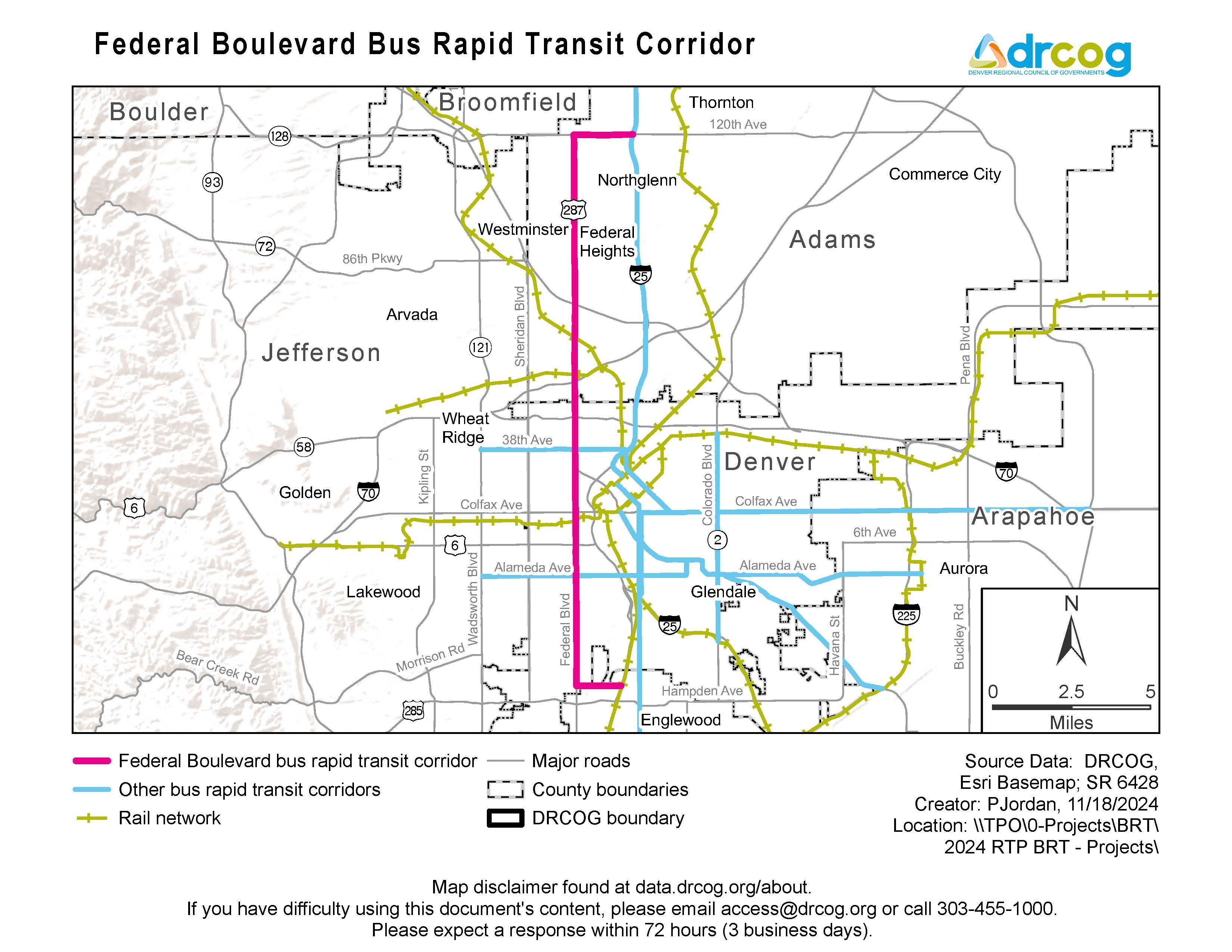
Current status: This project is currently in the design phase of the federal project development process of the National Environmental Policy Act.
Project website: Federal Boulevard bus rapid transit corridor.
Lead agency: CDOT.
Stakeholder agencies: Arapahoe County, City and County of Denver, City of Glendale, DRCOG and RTD.
Project and service limits: Infrastructure investments are planned along Colorado Boulevard between the A Line at 40th and Colorado Station and the E and H Lines at Colorado Station. The potential for additional bus rapid transit service south of Colorado Station is currently being analyzed as part of the planning process.
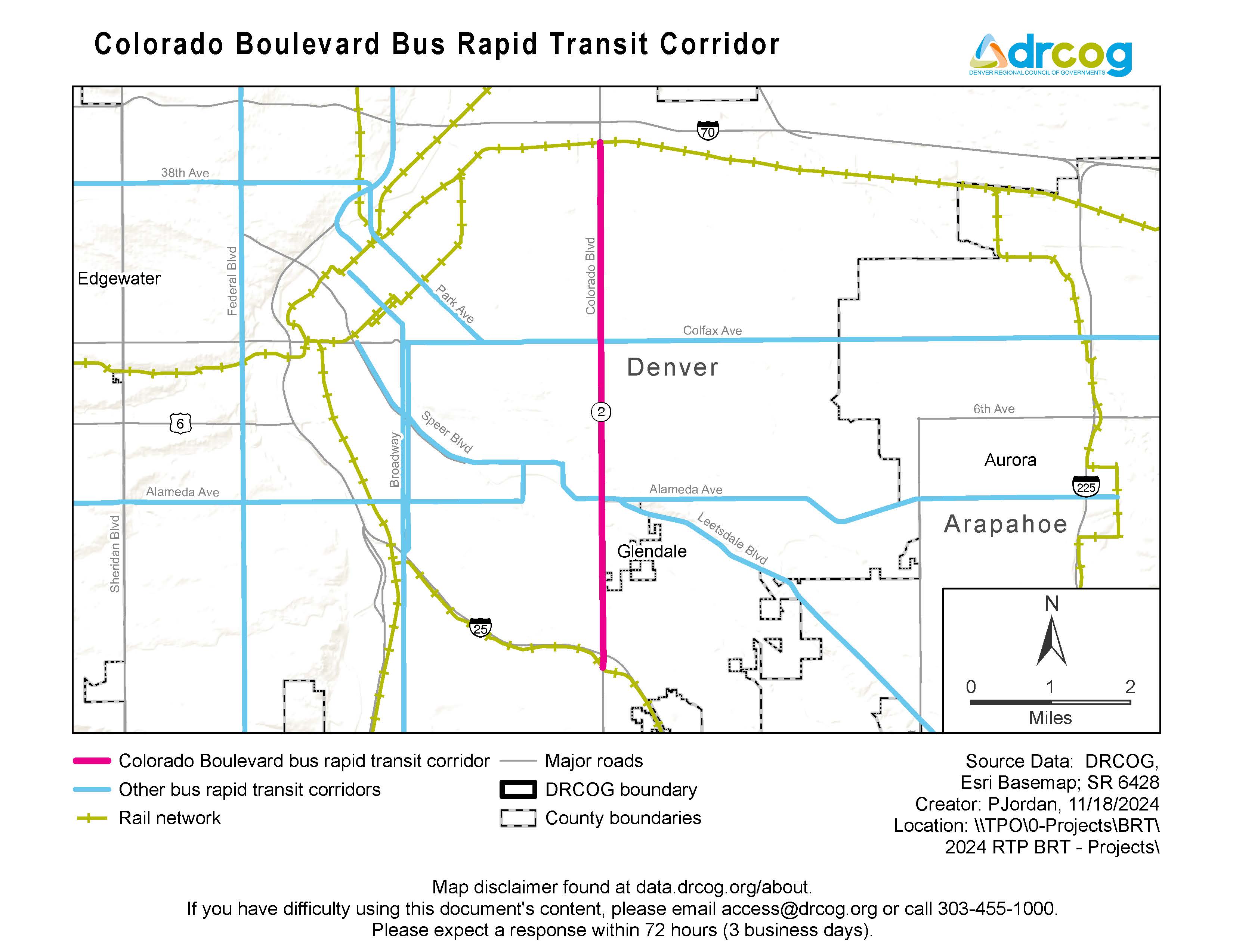
Current status: This project is currently in the Alternatives Analysis phase of the project planning, which is scheduled to be complete by the end of 2025.
Project website: Colorado Boulevard bus rapid transit
Lead agencies: City of Aurora and DRCOG.
Stakeholder agencies: Adams County, Arapahoe County, CDOT and RTD.
Project and service limits: The bus rapid transit service would extend from Interstate 225 and R Line east to approximately Picadilly Road and E-470, as defined in the 2050 Regional Transportation Plan. Planning and project development efforts will define exact project and service limits.
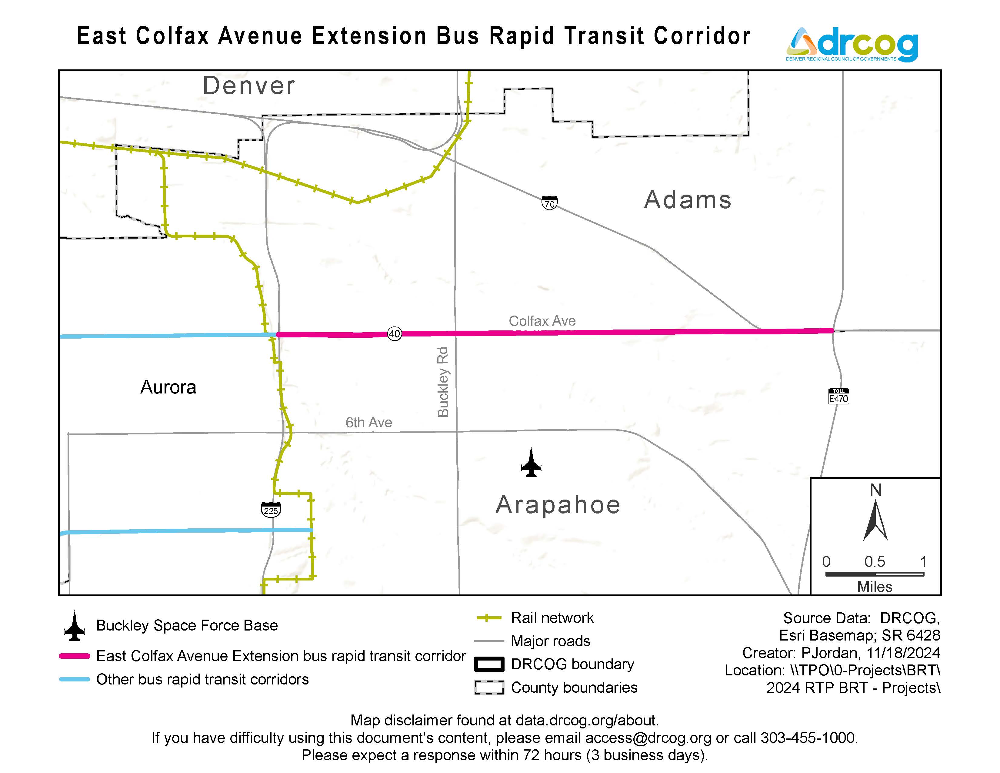
Current status: This project is currently undertaking a planning study (known as an Alternatives Analysis Study) to develop a Locally Preferred Alternative to advance into the formal project development process.
Project website: East Colfax extension.
Lead agency: DRCOG.
Stakeholder agencies: City of Aurora, City and County of Denver, City of Glendale, City of Lakewood, CDOT and RTD.
Project and service limits: The 2050 Regional Transportation Plan defines the bus rapid transit corridor from Wadsworth Avenue on the west to I-225 and R Line on the east.
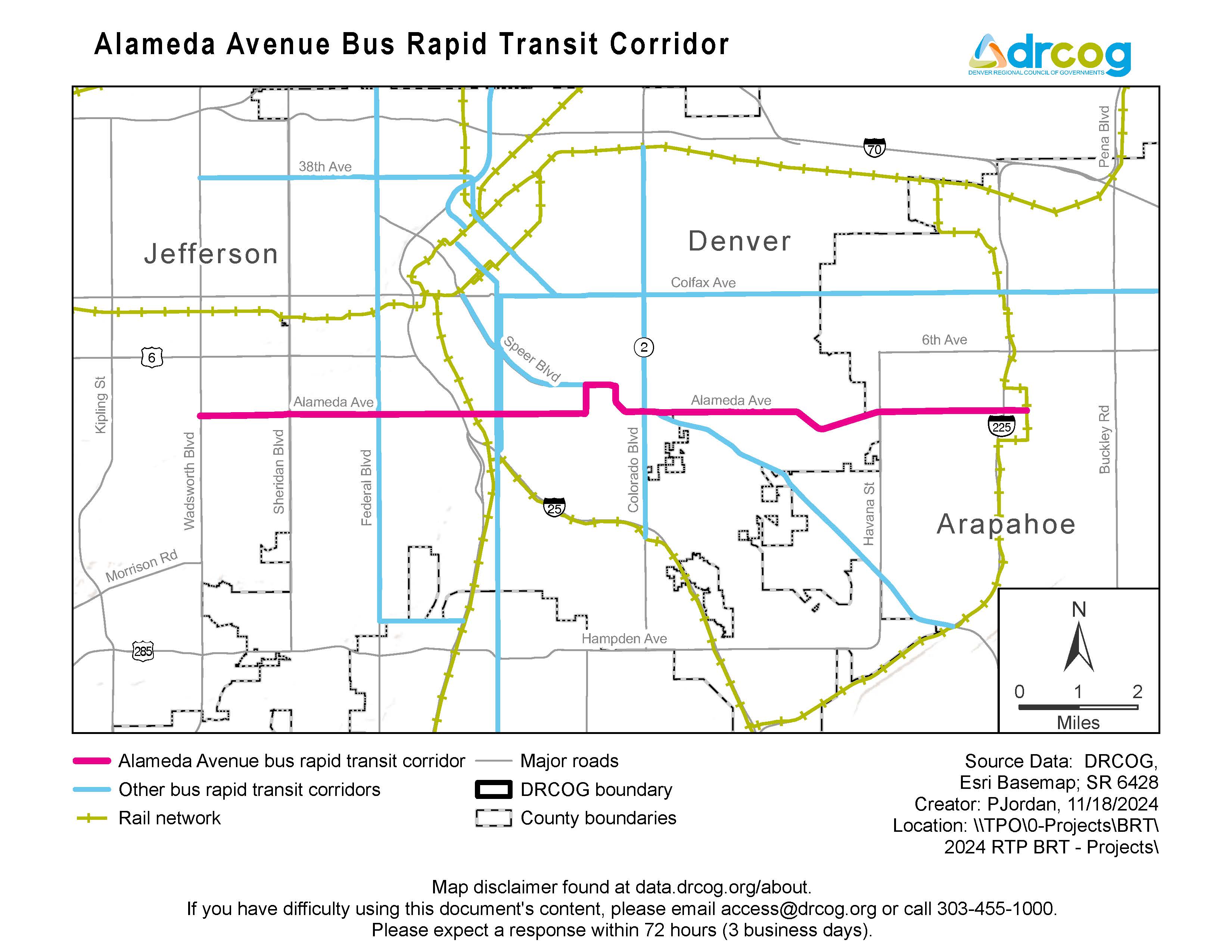
Current status: DRCOG completed a corridor vision study in 2024.
Project website: Alameda Avenue Study.
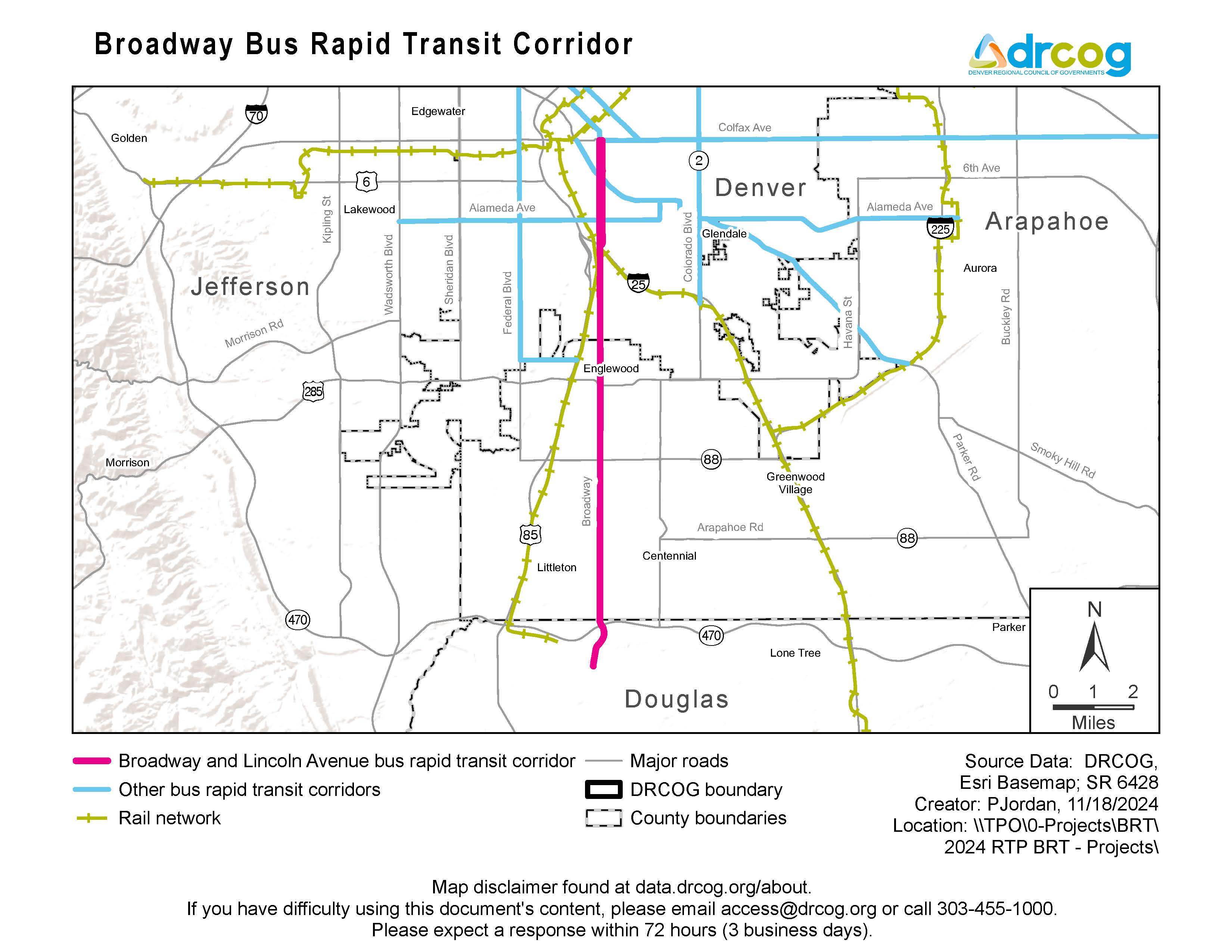
Lead agency: City of Littleton.
Stakeholder agencies: Arapahoe County, City of Centennial, City and County of Denver, City of Englewood, DRCOG and Douglas County.
Project and service limits: The 2050 Regional Transportation Plan defines the bus rapid transit corridor from East Colfax Avenue on the north to Highlands Ranch Parkway on the south.
Current status: A corridor study for a portion of the corridor from I-25 to Highlands Ranch Parkway was completed in 2024.
Study website: Broadway Corridor Study.
Lead agency: City and County of Denver for Speer Boulevard; Arapahoe County and Colorado Department of Transportation for Parker Road, also known as Colorado Highway 83.
Project and service limits: The 2050 Regional Transportation Plan defines the bus rapid transit corridor from East Colfax Avenue on the northwest to I-225 and R Line on the southeast.
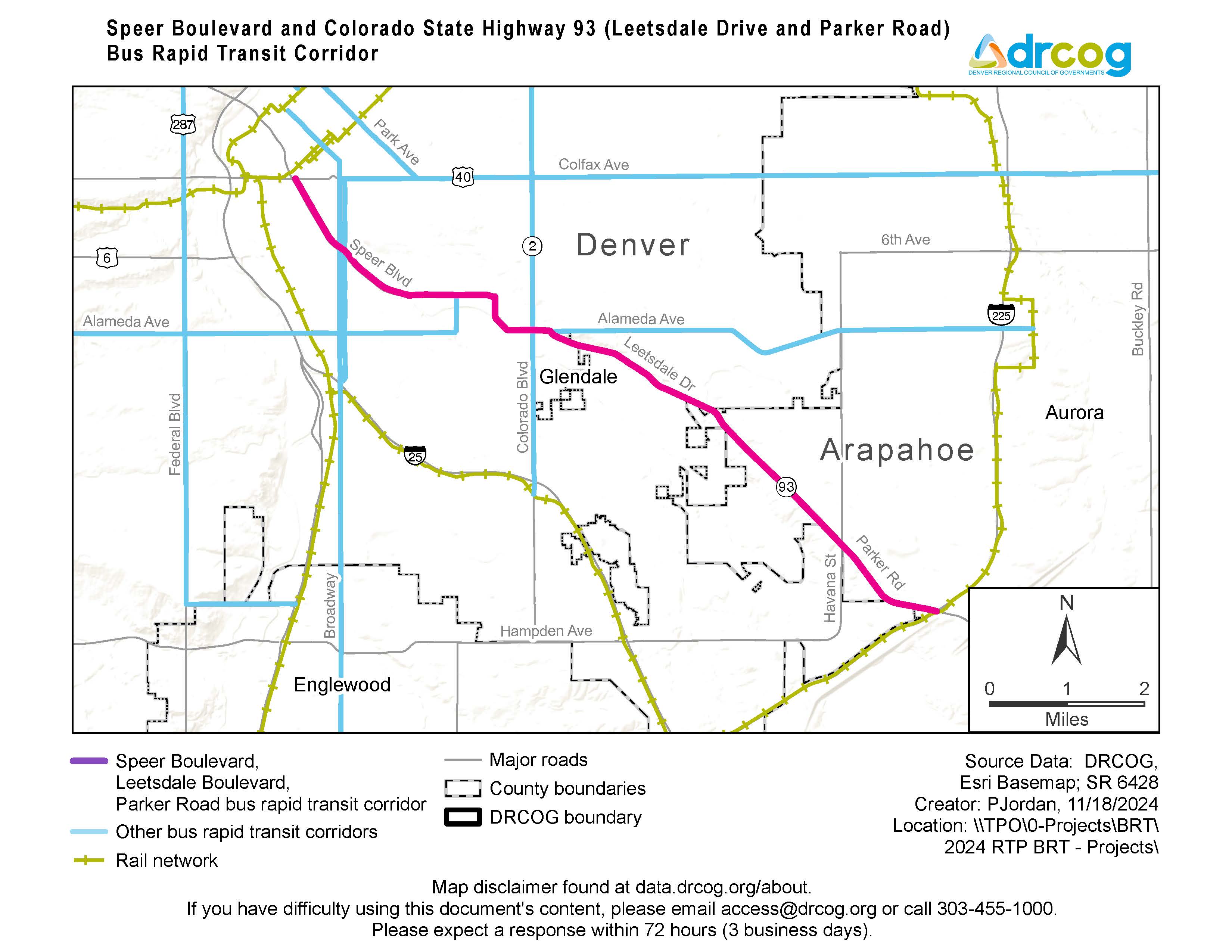
Stakeholder agencies: Arapahoe County, City of Aurora, City and County of Denver and DRCOG.
Current status: Multiple corridor studies have been completed covering portions of the corridor.
Study websites: Three studies have been completed along the corridor:
Lead agency: City and County of Denver
Project and service limits: The 2050 Regional Transportation Plan defines the bus rapid transit corridor from Wadsworth Boulevard on the west to East Colfax Avenue on the southeast.
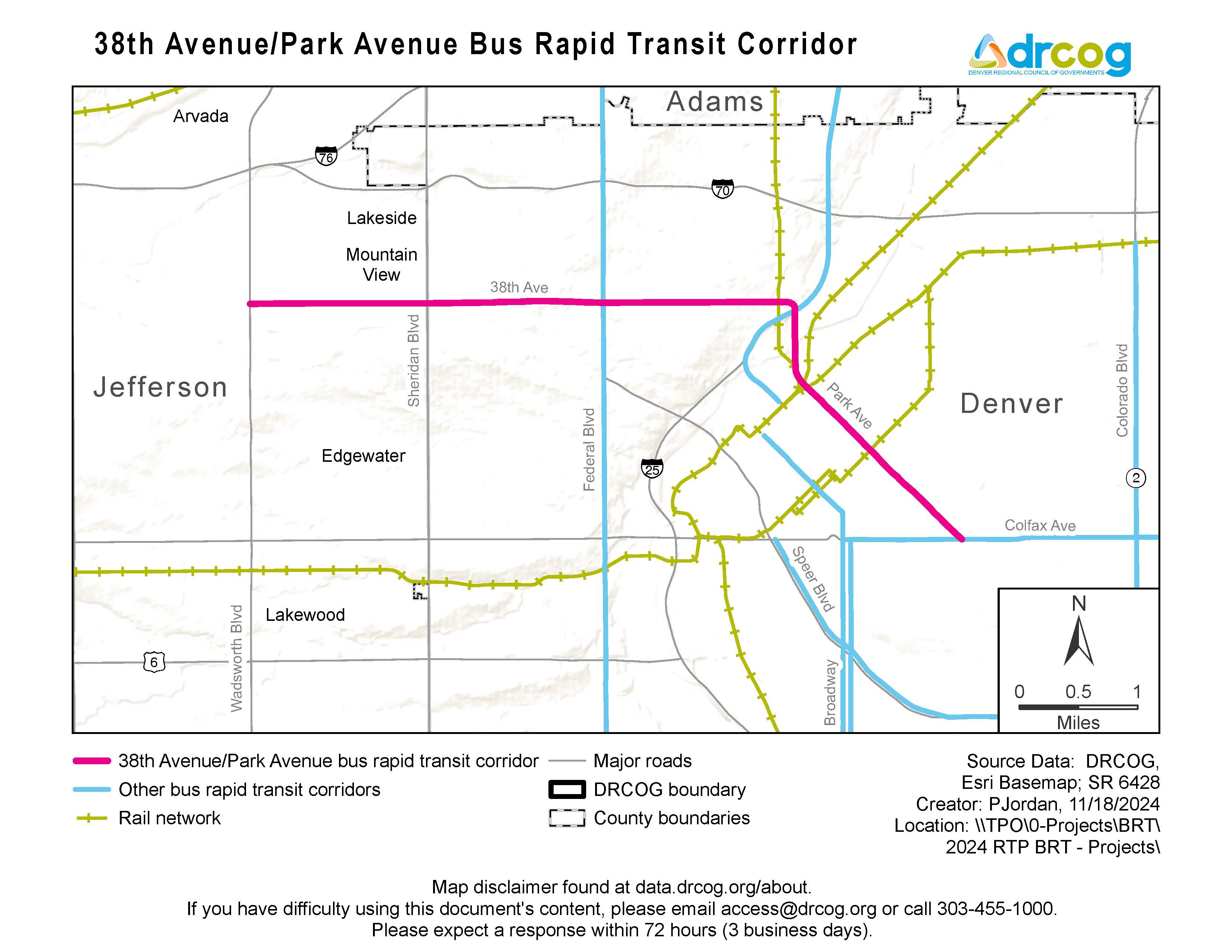
Current status: Corridor study in-progress.
Study website: The City and County of Denver is currently undertaking a study for the portion of the corridor from Sheridan Boulevard to I-25. Visit West 38th Avenue Corridor Study.
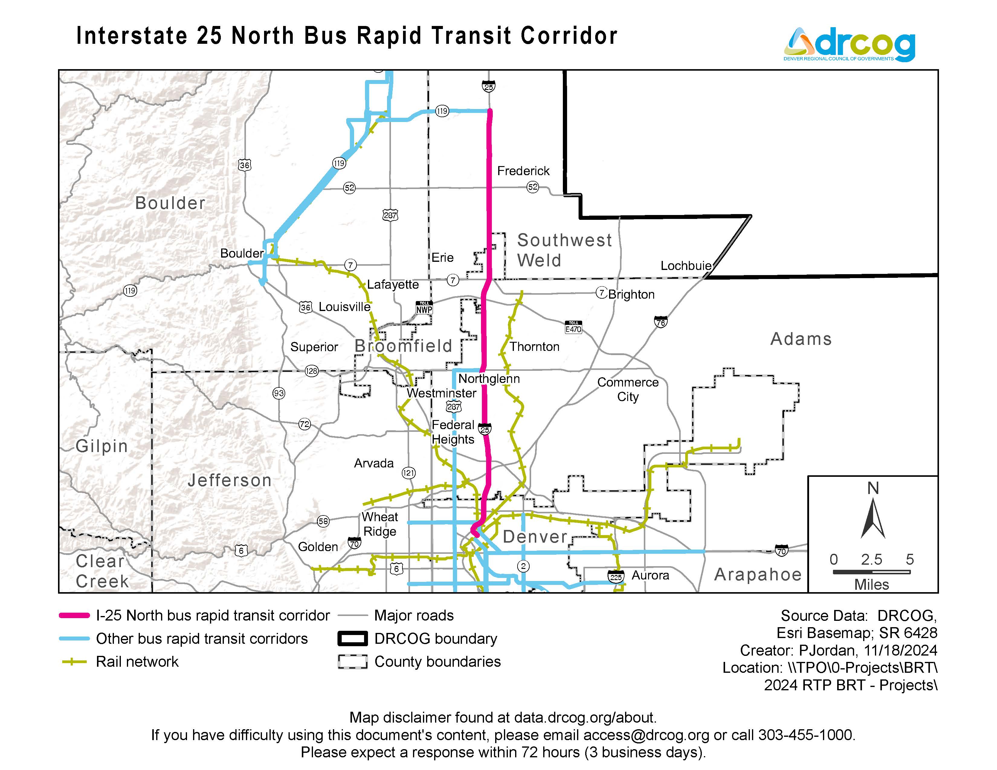
Corridor limits: Downtown Longmont to I-25 and Colorado Highway 119 Mobility Hub.
Status: Significant planning or development activities have yet to start.
Corridor limits: Denver Union Station to I-25 and Colorado Highway 119 Mobility Hub.
Current status: Significant planning or development activities have yet to start.